One source of truth — whether it's a single project or a multi-site rollout. We handle as-built conditions so your team can design, coordinate, and deliver without surprises or blown budgets.
Start every project with clarity. From day one, we deliver precise, verified as-built documentation tailored to your workflow—deliverables fit to your needs, including as-built plans, photo documentation, VR site tours, CAD drawings, Revit models, site survey reports, and more.
As-Built Plans
As-built plans document real-world conditions over time. Living blueprints that provide a solid foundation for modifications, renovations, and design updates.
Floor PlansElevationsSections
LiDAR Scanning
We deploy professional-grade LiDAR scanners to capture every surface, wall, ceiling, column, and MEP element at ±2mm precision. Whether it's a single tenant space or a 200-site rollout, every location is scanned to the same standard — giving your team accurate, consistent data without a site visit.
Raw LiDAR scan data converted into fully coordinated Revit models — delivered at any Level of Detail. Compatible with all major BIM platforms so your team can work directly from real-world conditions.
Revit ModelsAny Level of DetailBIM Ready
VR Site Surveys
Using Matterport Pro3 cameras, we capture immersive 4K 360° virtual tours of every site. Your architects, engineers, and PMs can walk the space from any device — measuring, annotating, and reviewing conditions in real time without traveling to the location. Every phase documented: pre-construction, mid-project, and closeout.
Integrates with: BIM 360 · Procore · Shareable Link
Matterport Pro34K 360°Any DeviceRemote Access
Drone Aerial Services
High-resolution aerial imagery, mapping, and inspections. Our drones access steep roofs, tall structures, and challenging areas to deliver data no ground crew can match.
4K VideoOrthomosaic MappingRemote Inspection
Site Reports
In-depth evaluations of existing conditions, progress updates, safety compliance, ADA inspections, and construction discrepancy documentation.
Safety ChecksADA InspectionsPunch Walks
Existing Conditions Evaluation
Capture true existing conditions before a single drawing is drafted — arming your design team with real data to plan confidently and eliminate costly assumptions.
MEP CaptureStructuralArchitectural
Digital Twins
A real-time virtual replica of your physical asset — used for monitoring, maintenance, and decision-making throughout the full project lifecycle. Built from verified scan data.
Real-TimeFull LifecycleIoT Ready
Point Cloud Conversion
Raw LiDAR scan data converted into clean, actionable deliverables — Revit models, CAD files, or mesh surfaces. We handle the processing so your team gets files they can use immediately.
.RCP / .E57 / .LASRevit ReadyCAD Ready
P&ID Integration
Piping and Instrumentation Diagram integration with 3D models — essential for industrial, manufacturing, and process facility projects requiring precise system documentation.
IndustrialProcess PlantsSystem Docs
CAD Deliverables
Clean 2D and 3D CAD files from scan data — floor plans, elevations, sections, and reflected ceiling plans in DWG format compatible with all major platforms.
DWG2D & 3DAll Platforms
Scan-to-BIM / Revit Models
Accurate as-built data converted into fully coordinated Revit models. Compatible with ArchiCAD, Navisworks, and all major BIM platforms — delivered at any Level of Detail.
RevitArchiCADNavisworks
MEP & Equipment Verification
Verify mechanical, electrical, and plumbing systems and equipment placement with millimeter accuracy — ensuring retrofits and new installations fit before work begins.
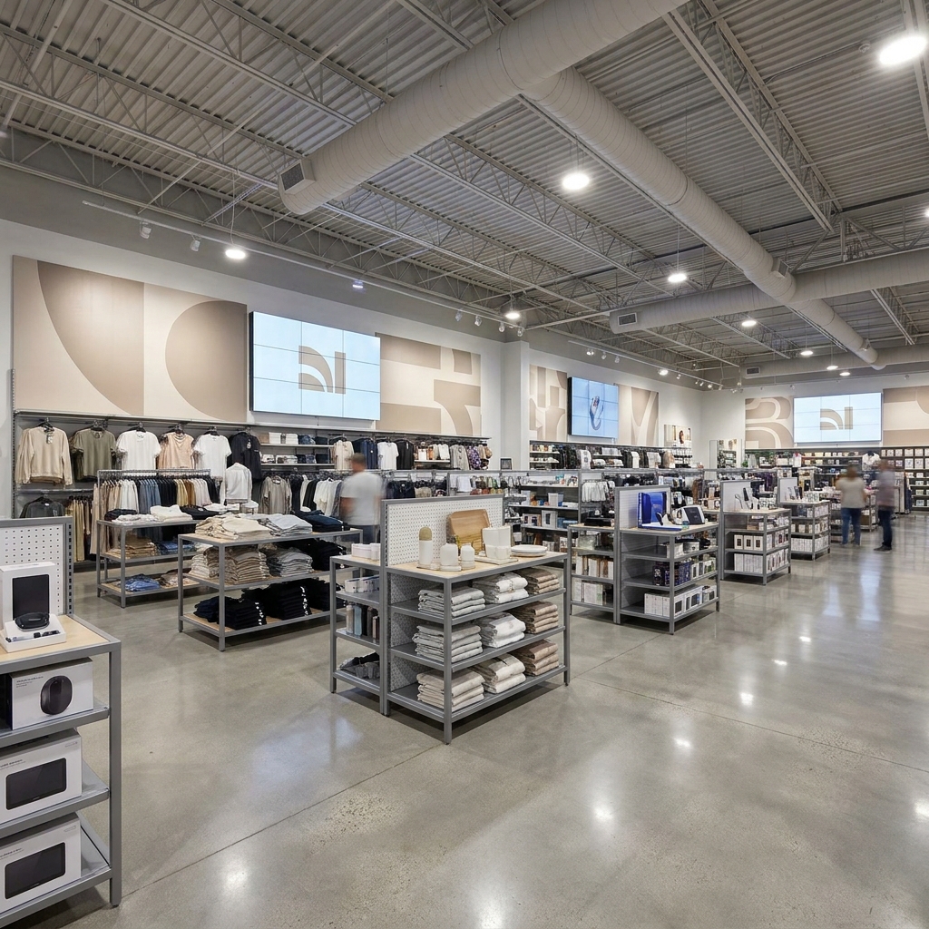
Prototype-based remodel programs, national tenant fit-outs, and multi-location rollouts. Standardized deliverables across every site so your design team works from real conditions — not assumptions.
Generic building shapes and massing. No real MEP shown yet. Used for early planning and feasibility studies.
MassingFeasibilityEarly Planning
2
Level of Detail 200 – Approximate / Design Development
Walls, floors, and ceilings represented as general volumes. MEP systems shown roughly as routing ideas. Good for design coordination and initial cost estimation.
Design CoordinationMEP RoutingCost Estimation
3
Level of Detail 300 – Construction / Major Systems
Major MEP systems appear (ducts, piping, electrical runs). Walls and ceilings are modeled accurately for coordination. Suitable for clash detection and construction-ready drawings.
Clash DetectionMEP SystemsConstruction Docs
4
Level of Detail 400 – Fabrication / Above Ceiling
MEP elements modeled for installation, with exact routing and connections. Above-ceiling walls and structures fully represented, including penetrations and supports. Ready for fabrication and final installation planning.
Fabrication ReadyAbove CeilingExact Routing
5
Level of Detail 500 – As-Built / Verified
Reflects the actual installed conditions. Walls, ceilings, and MEP systems verified on-site. Perfect for operations, maintenance, and future renovations.
As-Built VerifiedOperationsFuture Renovations
LiDAR Scanning
TechnologyLiDAR
Accuracy99% True Accuracy
Precision±2mm
CoverageNationwide
DeliverablesRevit, CAD, Point Cloud
Formats.RCP / .E57 / .LAS
BIM PlatformLatest Revit Version
Level of Detail RangeLevel of Detail 100 — 500
CoverageNationwide
CompatibilityRevit / AutoCAD / Navisworks
Drone Aerial Services
Video Resolution4K UHD
ImageryHigh-Res Still + Video
PositioningGPS-Tagged / RTK
MappingOrthomosaic / Topographic
InspectionsRemote / Rooftop / Aerial
VolumetricsSite Calculations
AccessSteep Pitch / High Structure
DeliverablesVideo / Photos / Maps / Reports
CoverageNationwide
Use CasesProgress / Inspection / Marketing
VR Surveys
PlatformMatterport Pro
Capture4K 360° Imagery
AccessAny Device
SharingShareable Link
ToolsMeasurement + Annotation
Use CasesProgress / Compliance / Remote
Site ReportsADA / Safety / Punch Walks
IntegrationBIM 360 / Procore
CoverageNationwide
OutputVirtual Tour + Point Cloud
Ready to eliminate the guesswork on your next project?
Whether it's one location or a nationwide rollout — let's talk scope, timeline, and deliverables.
Can you handle a rollout program across 20, 50, or 100+ locations?
Yes — multi-site programs are our core focus. We build a rollout schedule aligned to your construction timeline, assign a dedicated program coordinator, and deliver standardized files across every location so your team doesn't have to reconcile inconsistent data.
Will deliverables match our prototype Revit template and naming standards?
Absolutely. Before the first site is scanned, we align to your template, layer naming conventions, and file structure. Every deliverable drops into your workflow without reformatting — whether it's location 1 or location 75.
How accurate are the scans — and what's the precision on as-built drawings?
Our LiDAR scanning achieves ±2mm precision on raw scan data. As-built drawings are typically accurate to ±1/8 inch. We maintain equipment logs per project and provide them on request for your records.
What's your turnaround time per location?
Most locations are delivered within two weeks of the scan date. For rolling rollout programs, we build a phased delivery schedule at project kickoff so your design team always knows when to expect each location's files.
Do you work directly with our GC on-site, or do we coordinate separately?
We coordinate directly with whoever you need — your GC, local project manager, or facilities team on-site. You set the access protocol once and we handle coordination at every location from there.
What BIM platforms and file formats do you deliver?
We deliver Revit models (all recent versions), AutoCAD DWG, Navisworks NWD/NWC, and point cloud formats (.RCP, .E57, .LAS). VR tours are delivered as shareable links with BIM 360 and Procore integration available.
How does scanning reduce change orders on our remodel program?
Most change orders on remodel programs stem from design assumptions that don't match real site conditions — walls that aren't where the old drawings say, MEP routing that conflicts with new plans. Scanning captures true existing conditions before your architects produce a single drawing, eliminating those surprises before they become RFIs and change orders on the job site.
What equipment do you use for scanning?
We use professional-grade LiDAR laser scanners, Matterport Pro3 360° cameras, and FAA-licensed drone systems. All captured data is processed using specialized software and goes through internal QA before delivery.
I just need a floor plan of my space — is that something you do?
Absolutely. You don't need a large-scale project to work with us. If you need an accurate floor plan for a remodel, permit drawing, fire alarm layout, lease documentation, or any other reason — we can scan your space and deliver exactly what you need. Reach out and we'll scope it out quickly.
We're not sure if we need LiDAR — we just need existing conditions documented. Where do we start?
That's exactly what we do, and you don't need to know anything about LiDAR to get started. Whether your contractor needs accurate measurements before bidding, your architect needs to know what's behind the walls, or you just need a reliable record of your space — tell us what you're trying to accomplish and we'll recommend the right deliverable. Most projects start with a quick call.
Do you provide services beyond the ones listed on your site?
Yes — all the time. Every project has its own set of needs, and we build our scope around yours. We're constantly adopting new tools, methods, and workflows, so if you have a requirement that doesn't fit neatly into a standard deliverable, reach out. Chances are we can handle it or we'll tell you honestly if someone else is a better fit.
Can you scan occupied buildings or active job sites?
Yes — it's one of the most common scenarios we work in. We schedule around your business hours, coordinate directly with on-site staff, and can work in phases or after hours when full access isn't available. Active job sites, occupied retail stores, operating facilities — we've handled all of them without disrupting operations.
Still have questions? Book a consultation and we'll walk through everything.
No matter how big or small your project is — a single location, a regional rollout, or a 200-site national program — we bring the same precision and consistency to every engagement. One bad as-built becomes a change order, a blown budget, and a delayed opening. We eliminate that risk so you can build with confidence at any scale.
A commercial property owner needed accurate existing conditions documented before a major renovation. Working directly with the project team on a compressed schedule, we captured the entire facility and delivered a Revit model, floor plans, point cloud, and VR walkthrough built directly from the scan data.
Result: Designers worked from verified field conditions instead of outdated drawings, helping eliminate surprises during construction. When walls, equipment, and building systems are modeled accurately, designs fit the first time, reducing RFIs, rework, and costly change orders. For owners, architects, and contractors, that means faster decisions, smoother renovations, and greater confidence throughout the project.
A client preparing for a multi-location rollout needed consistent existing-condition documentation across multiple facilities. We scanned each site and delivered standardized packages including CAD drawings, floor plans, VR walkthroughs, site photos, and area calculations.
Result: Design teams could work from the same reliable information at every location, reducing field visits and ensuring fixtures, millwork, signage, and equipment were designed to fit before construction began. The result was a streamlined rollout process with fewer surprises and greater consistency across the entire program.
A multi-story high-rise required precise documentation of tenant suites, commercial spaces, and shared common areas within an occupied building. We coordinated with the client's LiDAR scanning team to execute the project in multiple phases, working across multiple tenants to minimize disruption. The collected data was then used to develop a coordinated Revit model with verified area calculations and accurate lease-line documentation.
Result: Ownership gained reliable square footage data they can confidently use for leasing, tenant negotiations, budgeting, and long-term planning. The improved accuracy provides a clearer understanding of the property, eliminates reliance on outdated drawings, and delivers defensible documentation when precision is critical.
An industrial facility required accurate documentation of existing piping, equipment, and infrastructure while maintaining active operations. We coordinated scanning around production schedules and delivered a detailed digital representation of the facility, including 3D plant models, piping documentation, and engineering-ready deliverables.
Result: Engineers could confidently design upgrades, retrofits, and equipment installations using accurate as-built conditions. By identifying potential conflicts before construction, the project team reduced field modifications, avoided unexpected shutdowns, and improved planning for future maintenance and expansion.
A project team needed accurate site documentation and aerial data before beginning design and construction activities. Using drone-based capture technology, we created a measurable digital representation of the site, providing detailed imagery, mapping, and elevation information.
Result: Teams gained a clear understanding of existing conditions before mobilization, allowing grading, layout, logistics planning, and site development decisions to be based on current field data. From retail developments to industrial campuses, aerial mapping provides a faster, safer, and more comprehensive view of a site before work begins.
Before any remodel begins, Construction Visions scans the site — it's non-negotiable for us. We've eliminated field conflicts that used to cost us weeks and drive costly change orders.
Architect & Owner
Derek A.
"
Construction Visions scans every phase — pre-construction, mid-project, and post. They're our eyes in the field, so we don't have to constantly travel to site, and we always have clear, up-to-date information to make decisions.
Construction Director
Jamie R.
"
Having existing piping mapped before we start is a game changer. We're catching conflicts in the model instead of on-site, saving weeks of rework — Construction Visions paid for itself on the first project.
Mechanical Engineer
Marcus T.
CV
Contact Us
Get Started Today
Share your site, scope, and goals. We'll respond within one business day with a customized plan and free quote. Most projects delivered in 1–4 weeks depending on scope.